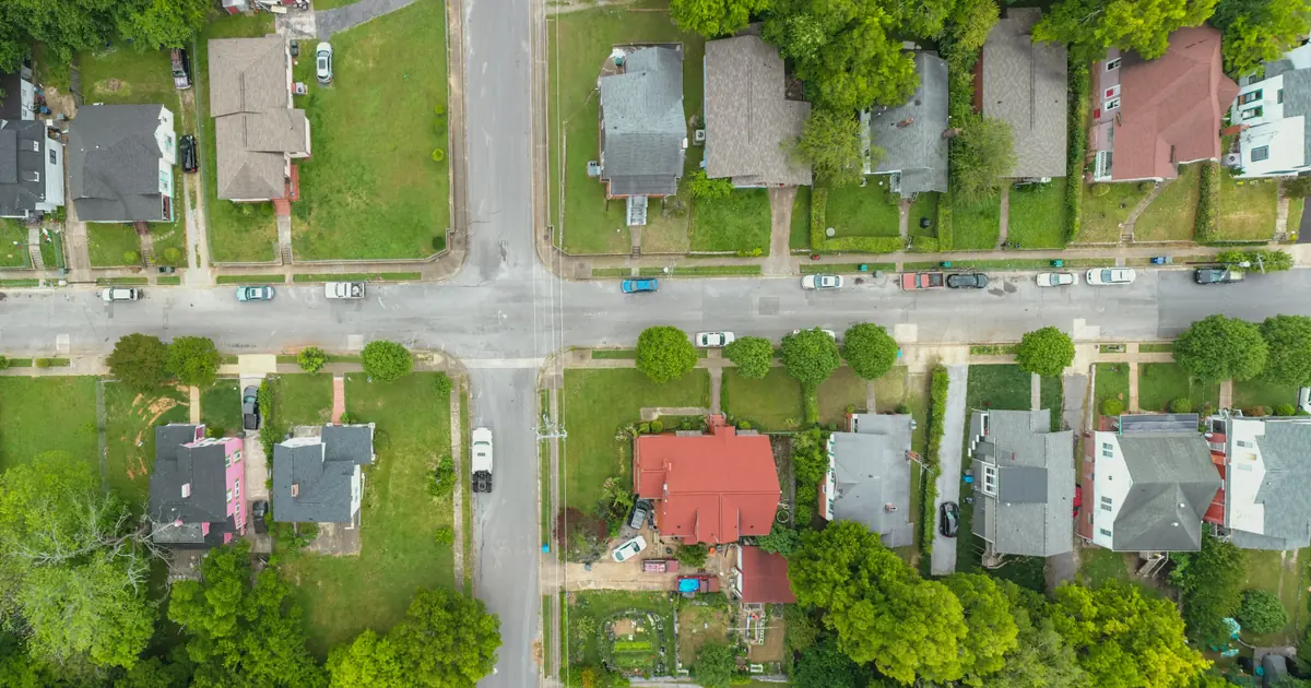
Drone stills added to a real estate shoot you are already doing run $100 to $200 in most US markets. A standalone aerial visit, where the drone is the only reason you are there, runs $200 to $400 for a house, and stills plus a 60 to 90 second aerial video land at $350 to $600. In the UK the add-on sits around £100 to £175, a standalone property pack at £200 to £350, with London and the South East about 20 percent higher. Commercial buildings start at $500 and construction progress work is quoted per visit on a contract.
The number agents push back on is the add-on, because to them it is ten minutes in the garden. It is ten minutes in the garden plus a licence, a policy, an airspace check and a forecast you watched for two days. Price those, and the ten minutes take care of themselves.
Should drone be an add-on or a standalone service?
Both, at different prices, and the gap between them should be wide. As an add-on you are already parked outside with the house prepped, so the marginal cost is setup, a 10 to 15 minute flight and 20 minutes of editing. $150 is a fair middle for 8 to 12 stills.
A standalone flight carries the whole drive, the whole airspace check and the whole weather risk on one small job. Quote it at roughly double the add-on, with a floor of $200, or £200. Below that, a 40 minute round trip for a ten minute flight loses you money.
Say it plainly when an agent asks why the price changes: "Drone with your listing photos is $150. A separate trip just for aerials is $275, because the drive and the weather risk land on one job."
How much more should drone video cost than stills?
Roughly two to three times as much, because the work is in the edit, not the air. Stills are a handful of heights and angles, colour matched to your ground shots. Video means planned flight paths flown three or four times each, then cutting, stabilising, grading and licensed music for a 60 to 90 second clip.
- Aerial stills only: 8 to 12 images, $100 to $200 as an add-on.
- Stills plus aerial clip: 60 to 90 seconds of aerial footage, $350 to $600.
- Raw drone footage only: $150 to $250, for an agent whose video editor wants the clips. Write in the quote that you deliver ungraded files and no edit.
What does the licence actually cost you?
Less in fees than people think, more in time. In the US, any paid flight needs a Remote Pilot Certificate under FAA Part 107. The knowledge test costs about $175 at a testing centre, drone registration is $5 for three years, and since 2021 the currency requirement is a free online recurrent course every 24 months instead of a second exam. The real cost is the 15 to 25 hours of study.
In the UK there is no separate commercial licence for low-risk flights in the Open category. Since 1 January 2026 you need a Flyer ID, a free online theory test, for any drone of 100g or more. The Operator ID costs £12.34 a year from April 2026. For a residential street the A2 Certificate of Competency is what makes the job workable: £99 to £199, valid five years, and it lets you fly a UK2 class drone 30 metres from uninvolved people, or 5 metres in low speed mode. A drone without a class mark flown under A2 still has to stay 50 metres away.
Spread these costs across the year's flights, like your camera body.
How do insurance and airspace checks get into the price?
Insurance first. The FAA does not require it, but agents, brokerages and every commercial client will ask for proof of $1 million in liability before you take off near their building. That costs $500 to $1,000 a year, more with hull cover for the drone itself. In the UK, liability insurance meeting EC 785/2004 is a legal requirement for any flight for commercial gain. Check what your general policy excludes using the photography business insurance guide, since most exclude aircraft entirely.
Airspace is the cost nobody quotes. In controlled airspace near a US airport, LAANC gives an automated authorisation in minutes where it is available. Where it is not, the request goes through FAA DroneZone and can take weeks. In the UK, a property inside an airport's Flight Restriction Zone needs permission from that airport first.
Ask for the postcode or ZIP before you quote. If the house sits under an approach path, say so: "This address needs airport permission, which takes up to two weeks. I can shoot the ground photos now and the aerials once it clears."
Who pays when the weather grounds the flight?
Agree it before the day, because the agent will not be in a generous mood after. Most consumer drones are rated for winds of about 24 to 27 mph, and gusts at roof height are worse than the forecast. Rain, fog and low cloud ground you too.
A workable clause:
- You make the go or no-go call by 7am on the day, from the forecast.
- An add-on flight moves to the next suitable day, free, and you deliver the ground photos on time.
- A standalone flight rebooked at the agent's request after you have travelled carries a $75 return fee.
- After two weather moves, either side may cancel the drone portion without charge.
The cancellation policy generator turns this into plain contract language.
How do you price drone work by property size?
The same way you price the ground shoot: by property, never by flight minute. A workable US structure for standalone jobs:
- Townhouse or lot under a quarter acre: $200 to $250. Often worth declining the drone entirely; a roof and a neighbour's satellite dish sell nothing.
- Detached home up to 4,000 sq ft: $250 to $350.
- Large home, acreage or waterfront: $400 to $600, because the story is the land, the boundaries and the distance to the water.
- Farms, ranches and estates over 10 acres: quote it. Boundary overlays and multiple launch points can make it a half day.
Fold the add-on version into your listing packages using the tiers in real estate photography pricing, so most agents pick drone inside a package rather than haggling over it alone.
How much should you charge for commercial and construction progress jobs?
Commercial property starts at $500 and runs to $1,500 for a single building, more for retail parks and industrial sites. The flying is similar, the paperwork is not: site inductions, a certificate of insurance naming the client, a risk assessment, and often a fixed early morning window before staff arrive.
Construction progress is the steadiest drone income there is. Quote a contract of monthly or fortnightly visits from the same launch points and heights, so each set lines up with the last. $250 to $500 per visit for a residential development is typical, with 15 to 20 percent off a one-off price in exchange for a six or twelve month commitment. Orthomosaic maps and 3D models are a different skill set and price; do not throw them in.
Licensing matters more here than anywhere. A developer will put your aerials on hoardings, in investor decks and on a website for years. Grant listing use only on residential work, and quote a broader licence for commercial clients, using the terms in photography usage rights.
What should you charge on your next drone job?
Write three numbers before the next enquiry arrives: $150 as an add-on, $275 standalone, $450 with an aerial clip. Adjust them to your market, then ask for the address before you send any of them. Deliver the aerial stills in the same gallery as the ground shots, and embed the aerial clip in the same gallery as a video block. That is the kind of thing a gallery platform built for photographers should already handle, so the agent forwards one link instead of three.